Led and designed key features of a data platform for scientists to discover and access contextual metadata for NASA's airborne and field Earth science observations, clearing the path to its official public launch. (2022-2024)
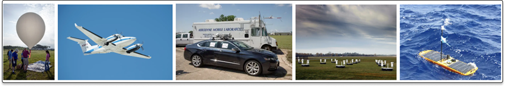
Airborne data is metadata about the Earth's surface and atmosphere gathered through the deployment of platforms (often aircraft) and instruments (such as sensors). Compared to the large swaths of data captured by satellites, this form of remote sensing is generally localized and context-specific. Raw data collected from the field can be processed and shared with other scientists for research. It can also provide ground truthing to what is observed from satellites.
An initiative managed by NASA's Airborne Data Management Group (AMDG) was born out of a need to improve access to airborne and field observations. Compared to satellite missions, this data varied in formats and was dispersed across different data locations. In many cases, metadata was stored in old film canisters in physical storage rooms. If the primary investigator of a mission retired, unarchived data would be lost. The process of data curation by the ADMG was necessary to improve airborne data management and stewardship.
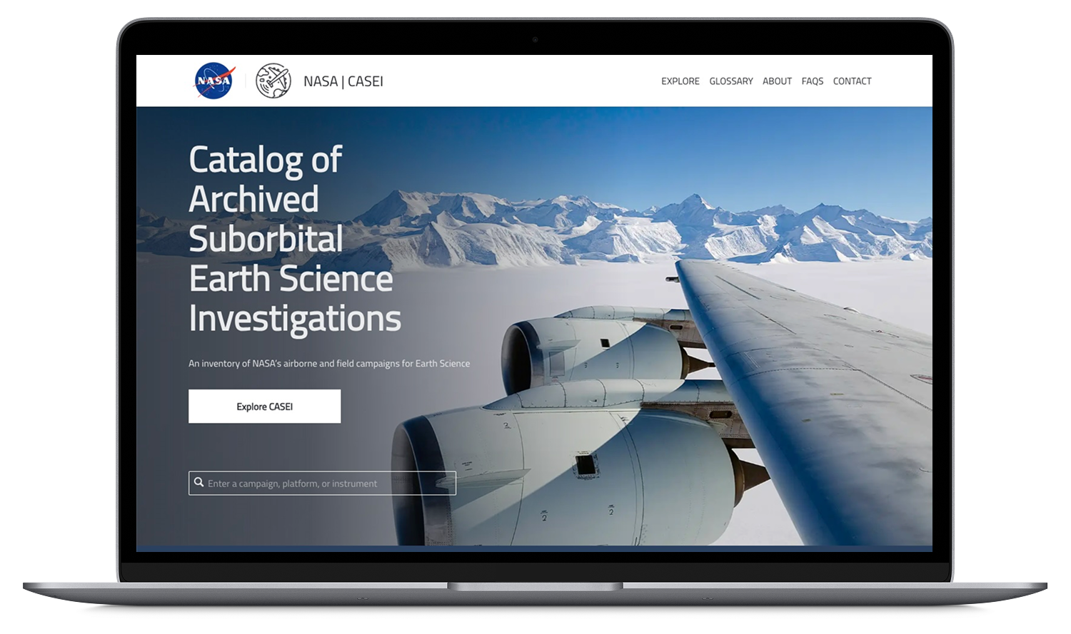
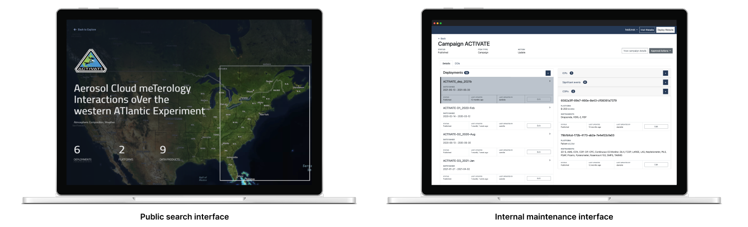
After curating metadata, the ADMG would share it on a data discovery platform called the Catalog of Archived Suborbital Earth Science Investigations (CASEI). This would not replace the main central NASA search platform where the raw data was available, but become a companion interface focused on additional contextual information about various missions, platforms, and instruments. Data curators would also have an internal maintenance interface to curate and manage content, replacing the previous method of managing everything in a massive Google Sheet.
I joined the team after the initial development of the CASEI platform and its backend content management system, stepping into the dual role of project lead on the development side and designer. The team structure was based on a partnership where my team (from Development Seed) provided the design and technical development support, while the NASA side had project/program managers and data curators.
For over two years, I led feature definition and design for platform improvements, both incremental and larger scale. While each project varied, I approached the challenges methodically from problem definition to design delivery, making sure the scope fit within the context of sprints (5 sprints per quarter). On a weekly basis, I led feedback and progress update sessions. On a quarterly basis, I participated in broader planning sessions to ensure that development planning fit within the larger team goals.
Sometimes the science keywords used in CASEI would get out of sync with NASA's keyword management system. I learned that science keywords weren't just single words, they consisted of an entire path of words based on hierarchical sets of vocabularies (e.g., "Earth Science > Atmosphere > Air Quality"). To ensure proper data syncing between both systems, the interface needed to focus on words in the context of an entire path of words. Our developer had built a keyword sync tool, but there was nowhere in the admin interface to review these keyword changes. After understanding the technical flow and structure of the keyword sync, I designed a set of user flows that scaled how the existing interface worked to notify and allow admins to verify three types of keyword changes (modifications, deletions, and new keywords) and then update all instances where a definition had changed.
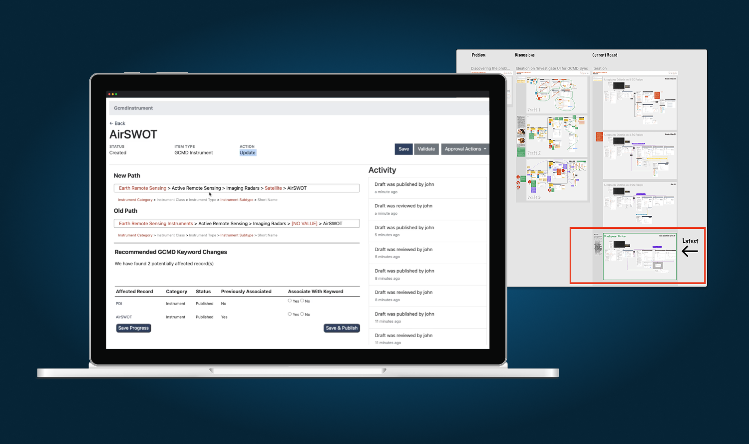
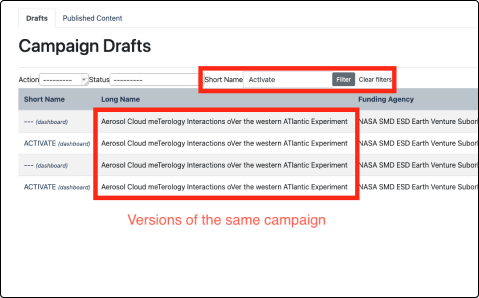
Throughout the year, I noticed that data curators were raising many quality-of-life issues around the admin interface. While we tried to address the easy fixes, it pointed to a broader workflow challenge. The admin interface was built quickly to work, so information was displayed in a way that reflected how the data model worked rather than the ideal admin experience. The most confusing part was that all content changes were displayed as "draft records" on a single table. As more of these drafts were added over time, they became harder to keep track of and too easy to accidentally update the wrong one. There were also parent/child/peer relationships between drafts that were displayed as a flat list, adding to the confusion. I advocated for a more holistic design approach with a new information architecture, involving the data curators who shaped the new design. It was also important to work with developers throughout to understand the data model so that we wouldn't make significant changes to the existing backend. Hierarchy was introduced and historical drafts were consolidated to help curators find the right content and ensure that edits were always made to the latest version.
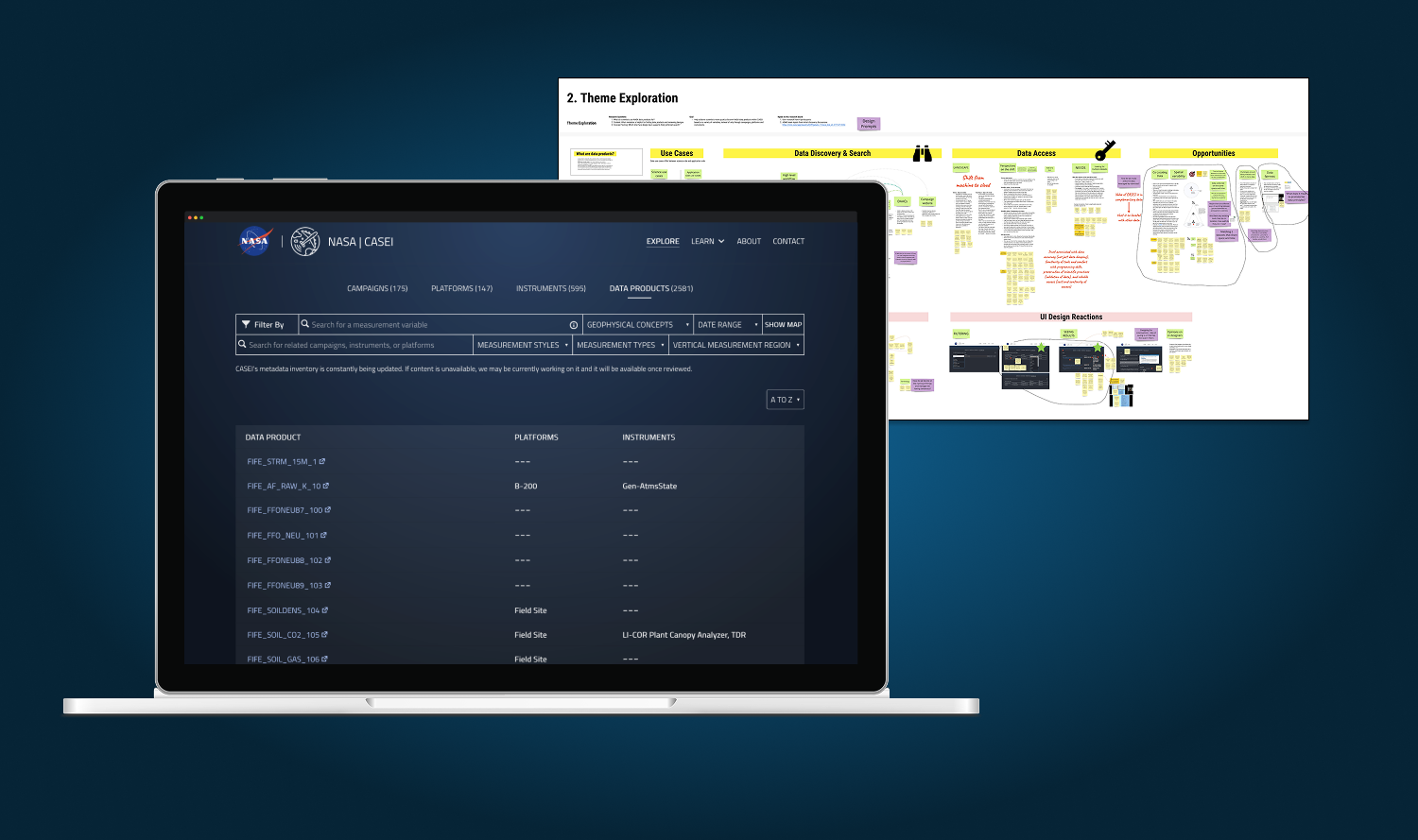
One of the long-standing requests based on feedback from an in-person airborne workshop was to add a data products search page. These were actual raw digital files (often bundled as a collection of files) in the NASA system based on groups that science users would find logically meaningful. Instead of immediately designing a new page, I pitched a round of user interviews with scientists to learn more about why scientists visiting CASEI would access data products and what kind of search metadata they would find most relevant. It was also an opportunity to increase the amount of user feedback loops throughout the project. I learned that one of the motivations for finding relevant data products was early in the science workflow when submitting a proposal for funding. Scientists might also need data products to help answer a science question, often looking for 3+ datasets related to whatever they are studying. After taking all the learnings into account, the final design prioritized the most relevant search filters (format and variables like temperature) and displayed results in a table showing the instruments and platforms associated with each data product.
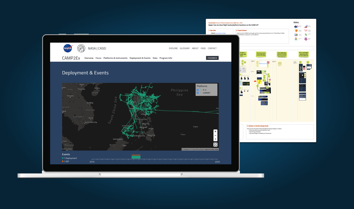
Another long-standing request was to show flight movements on a map for each campaign, making the catalog more interactive and engaging. I liked the idea of a map, but learned that it would be a difficult feature to automate across all campaigns because data formats varied significantly and often required extensive cleanup. It was more of a data challenge than a design one so I worked closely with a developer to propose a realistic workflow for visualizing as many flight maps as possible over time. In addition to the visual design template for each map, I put in place a workflow to prioritize and divide up the work across sprints and quarters. We ended up with about 10 flight maps during my time and those maps were extremely insightful and interesting additions, bringing the campaigns to life.
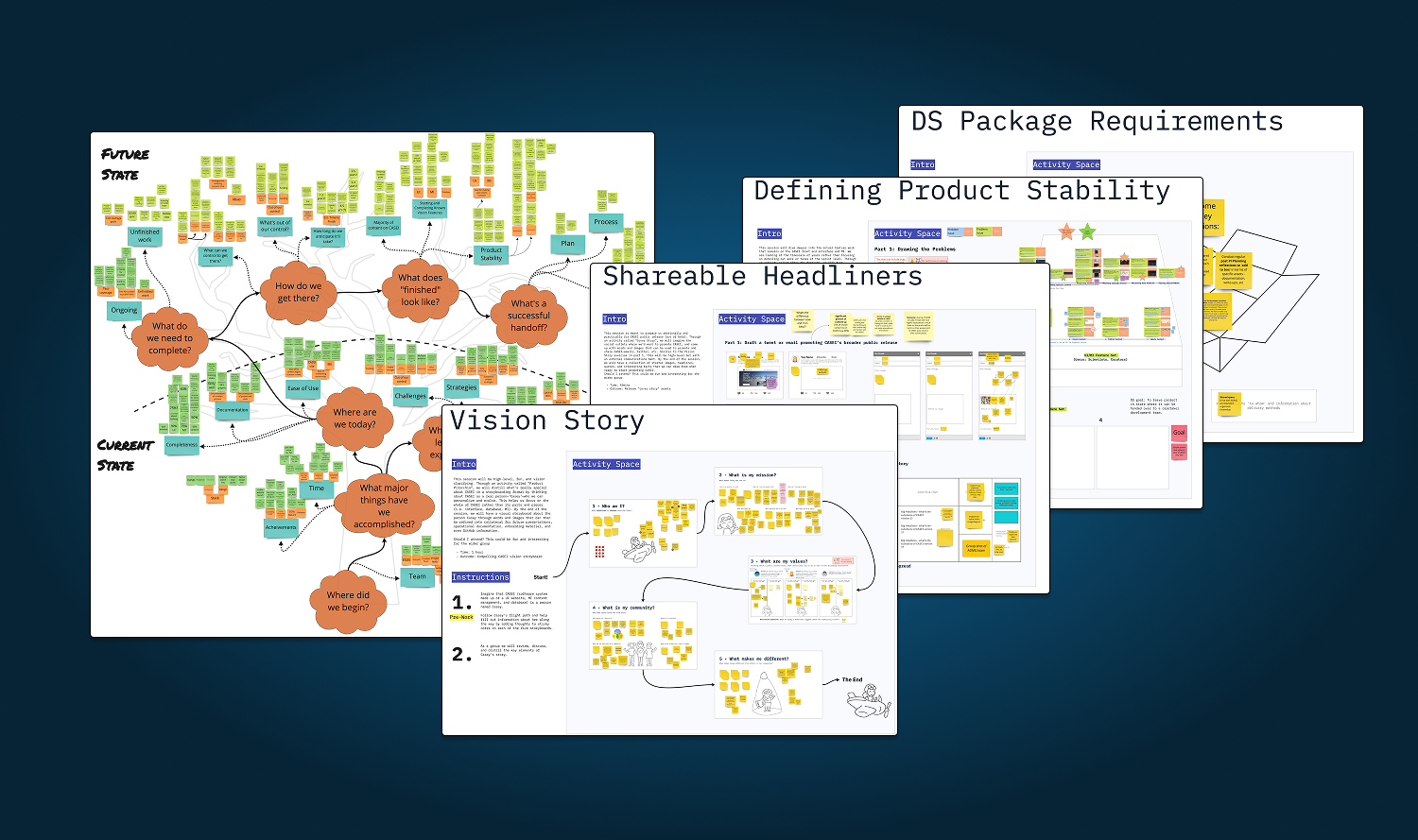
With the value of CASEI validated, an internal transition of the overall project was underway as the initial funding was for a proof of concept that was now approved for longer-term maintenance. I helped plan a series of co-design visioning sessions around the future state of the platform, in particular helping our development team transition away from the core team and prepare to hand off the project.
The ADMG was awarded the 2022 NASA Silver Group Achievement Award for excellence and teamwork in the development and implementation of a knowledge center for NASA airborne and field campaign data. In 2023, the platform transitioned from beta to full public release. I was proud to have developed strong relationships with the team and was honoured with the 2022 NASA IMPACT Spark Award for innovation. Since then, the inventory has continued to add more contextual metadata for past and new airborne and field campaigns.